

More than 2 feet (0.7 meters) of new snow snarled traffic in the Sierra on Monday while record rainfall in Reno forced the closure of one school and caused minor flooding that shut down some streets.
A winter storm warning remained in effect around Lake Tahoe until 11 p.m. Monday. But a stretch of Interstate 80 that closed overnight reopened, and floodwaters on rivers and streams continued to recede along the Sierra's eastern front.
The storm packing winds gusting up to 90 mph (144 kph) Sunday night dropped 29 inches (74 centimeters) of snow on Donner Pass, where I-80 crosses the top of the Sierra west of Truckee, California, the National Weather Service said.
All schools were closed Monday at Incline Village on Lake Tahoe’s north shore, where up to 18 inches (46 cm) of snow was recorded. A foot (30 cm) of snow was reported in California on Tahoe’s west shore at Homewood and 5 inches (12.7 cm) at South Lake Tahoe.
Get a weekly recap of the latest San Francisco Bay Area housing news. Sign up for NBC Bay Area’s Housing Deconstructed newsletter.
Snow and rain throughout the weekend helped raise the water level at Lake Tahoe back above the natural rim, allowing water to resume flowing into the Truckee River at Tahoe City, California.
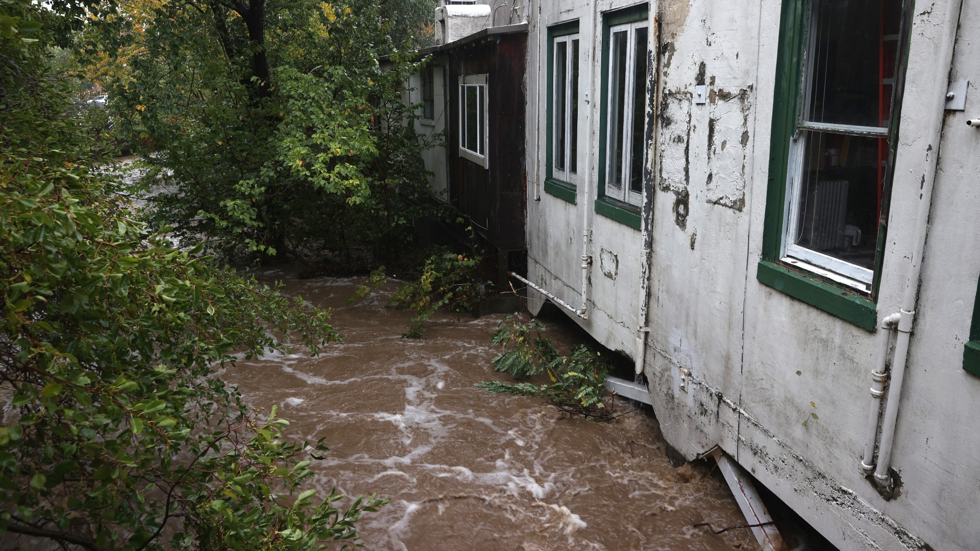
More than 6 inches (15 cm) of rain was reported west of Reno, nearly 5 inches (12.7 cm) in the valleys north of town, and more than 5 inches in parts of Carson City.
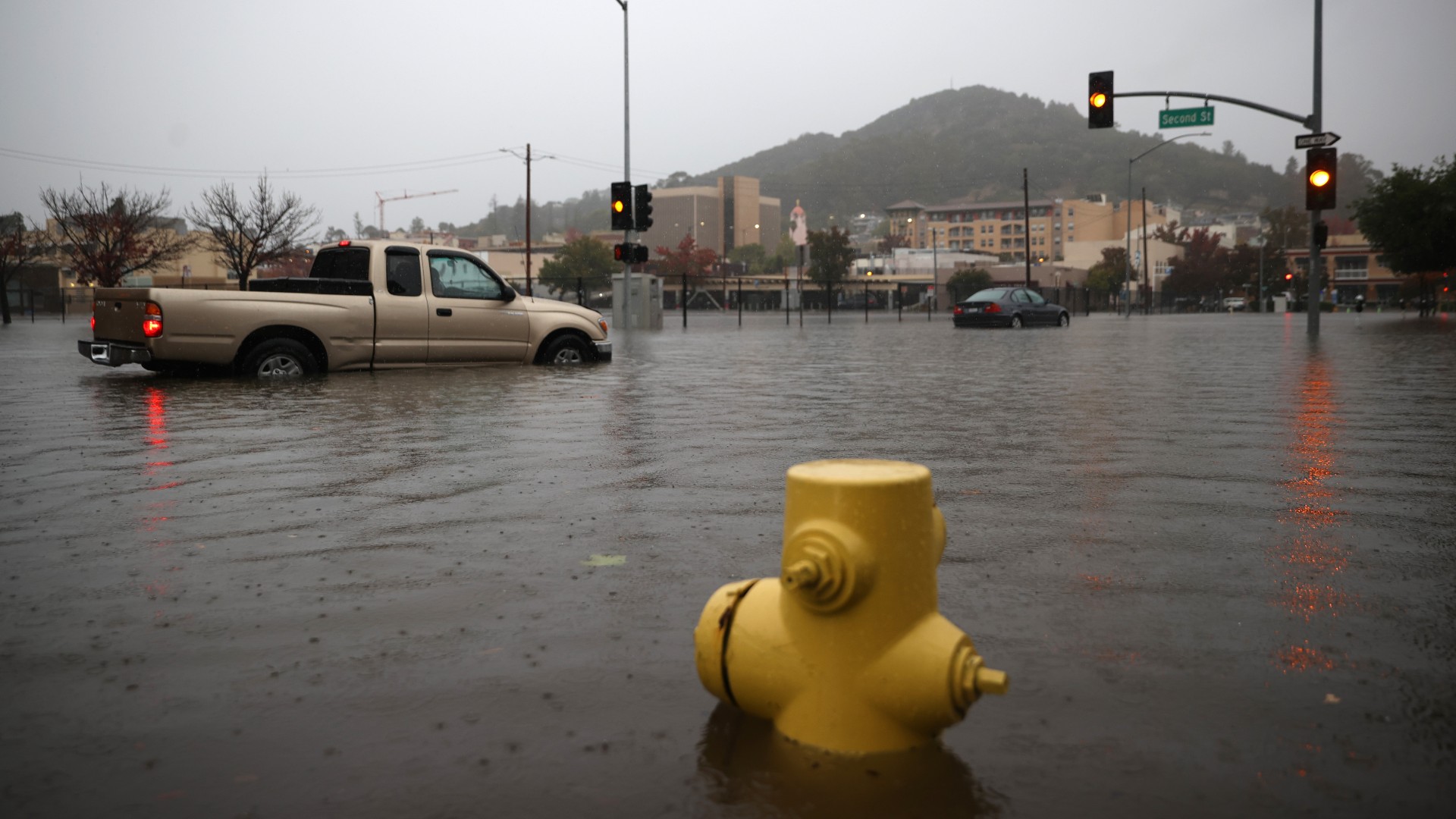
Reno High School closed because of major damage in multiple classrooms from rain through a leaky roof Sunday and overnight to Monday.
The Truckee River was receding from near flood stage on Monday after a record 1.88 inches (4.5 cm) of rain was recorded Sunday at Reno Tahoe-International Airport, breaking the old record for the day of 0.86 inches (2 cm) set in 1951.
By Monday morning, more than 2.5 inches (6.4 cm) had fallen at the airport over a 24-hour period, pushing the October rainfall total to a record 2.82 inches (7.1 cm), breaking the old mark of 2.65 inches (6.7 cm) set in 2010.
Rain and snow intensity was expected to diminish across the region into Monday night, with just a few additional inches of snow along the Sierra crest.
A high pressure ridge was forecast to build Tuesday Tuesday with temperatures warming through the week into 50s in the Sierra and 60s in the nearby valleys.
Photos: October Storm Lashes California
In Las Vegas, gusty winds up to 50 mph (80 kph) and rain were expected Monday, the National Weather Service said, before skies clear on Tuesday with a high near 70 degrees Fahrenheit (21 Celsius).
The weather service in Elko predicted Monday would be very wet and windy, and issued a flood advisory for northeast Nevada and a flood watch in the Ruby Mountains.
Snow levels were expected to drop to 5,000 feet (1,524 meters) with up to 6 inches (15 cm) of accumulation on the highest peaks.
Rainfall could create rockslides and debris flows canyon areas that experienced slides and flows in early August, the weather service said.
AP writer Ken Ritter contributed to this report from Las Vegas.
