
Wildfires left residents who live near burn areas facing another threat this winter in California. The fires stripped vegetation from hillsides, leaving those ares more susceptible to flooding and debris flows during storms.
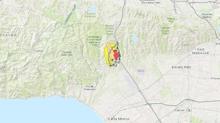
Use the map at this link, to see USGS maps of post-fire debris flow and flood hazard areas affected by wildfires in Southern California. The USGS uses factors live burn severity, soil properties and rainfall forecasts to estimate the probability and size of debris flows.
Even moderate rainfall can produce flooding in burn areas because they lack the vegetation that would normally absorb water. The fire-scarred hillsides have a repellent layer that blocks water absorption.
If it's not absorbed by the soil, rainwater simply washes down the hillside, sometimes with enough force to move boulders, tear out trees and damage buildings and bridges.
