The massive and destructive Caldor Fire continues to burn across the Sierra Nevada mountain range and into the South Lake Tahoe area.
Interactive Caldor Fire burn maps
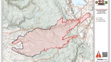
Use the interactive map below to see where the wildfire has already burned. The burn area is shown in blue.
Get a weekly recap of the latest San Francisco Bay Area housing news. Sign up for NBC Bay Area’s Housing Deconstructed newsletter.
The following interactive map shows where recent hotspots have been. To see the hotspots, zoom in on the Caldor Fire burn area. Next, go to the blue navigation bar at the top of the map, select the "Map layers" icon in the upper right-hand corner and be sure to check the following two boxes: Satellite (MODIS) Thermal Hotspots and Satellite (VIIRS) Thermal Hotspots and Fire Activity.
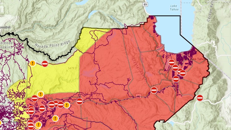
Caldor Fire perimeter map and containment lines
For a different perspective, the map below shows the wildfire's perimeter and containment lines as of Sept. 3.
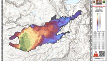
Where the Caldor Fire has burned recently
The map below shows how the wildfire has progressed, with the darker colors symbolizing more recent burn activity.