
Caltrans released an assessment Wednesday detailing the vulnerability of the Bay Area's highway and transportation infrastructure to the hazards of climate change, including rising sea levels, flooding and wildfire.
The last storm season brought floods, landslides and coastal erosion costing more than $1.2 billion in highway damage around the state. Roughly $390 million of that occurred here in Caltrans District 4, which includes San Francisco, Sonoma, Napa, Solano, Marin, Contra Costa, Alameda, San Mateo and Santa Clara counties.
District 4 contains roughly 110 miles of roadways and bridges that are expected to be affected by storm surge by the end of the 21st Century - with roughly 30 of those miles in San Mateo County alone.
The assessment spotlights U.S. Highway 101 near Corte Madera Creek, in Marin County, which is particularly susceptible to rising sea levels, according to Caltrans.
Sections of that roadway could see regular inundation several times a month during spring tides. A half-meter of sea level rise, coupled with storm surge from a 100-year weather event, could cause the water levels to rise above the Corte Madera Creek Bridge - a scenario that could occur as soon as mid-century.
The creek could also be subject to higher peak flow rates during extreme rainstorms, leading to serious flooding along its path.
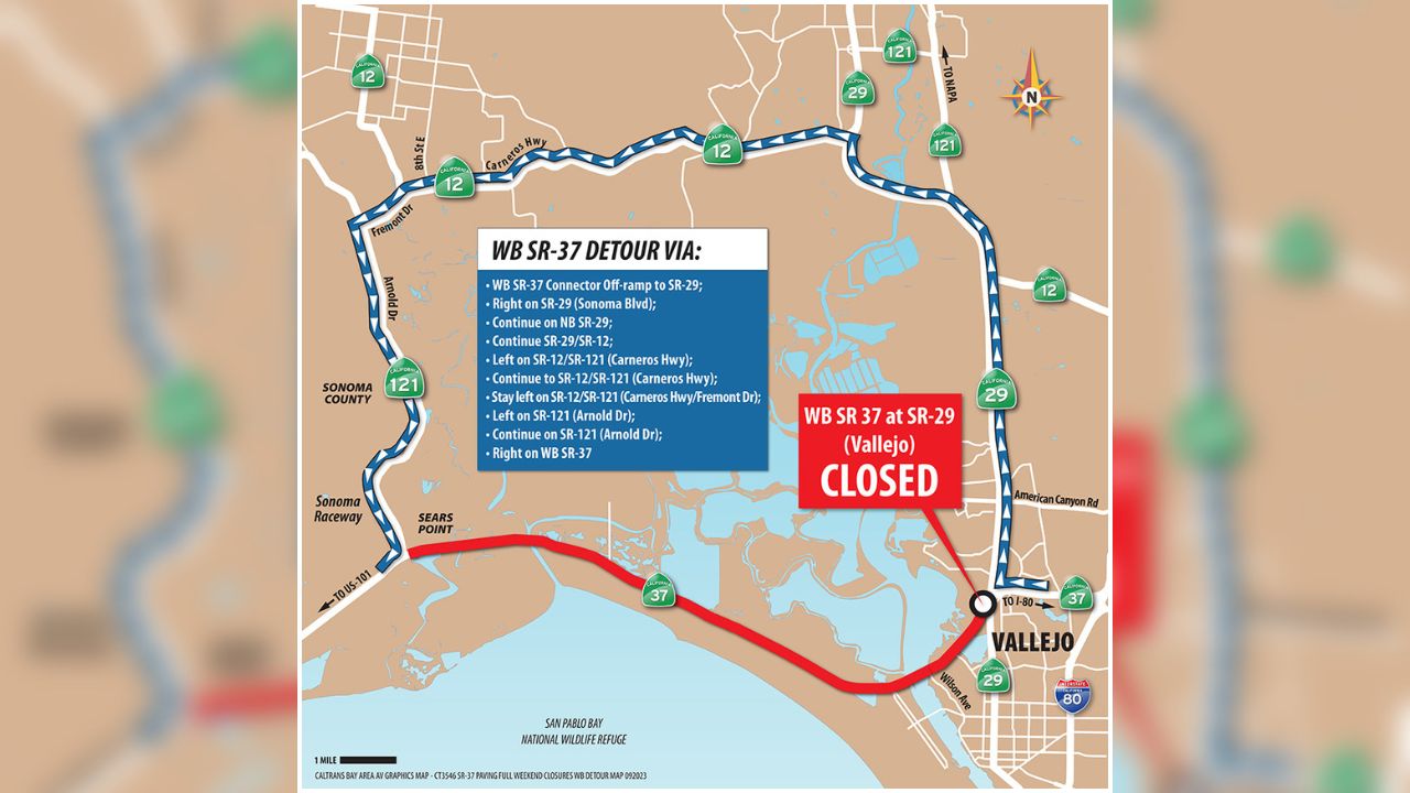
Segments of state Highway 37, which spans Sonoma, Marin and Solano counties are at risk of flooding again, as happened earlier this year in January and February.
Local
Segments of highway on either side of the Bay Bridge and the Richmond Bridge could also be subject to flooding, as could Highway 101 along the waterfront in San Mateo County.
In the Sacramento-San Joaquin River Delta area, which includes parts of the far East Bay, segments of state Highway 84 are built on top of levees, which may also be susceptible to the rising sea levels and erosion.
Due to the increasingly prevalent nature of major wildfires, the impacts they create may also need to be taken into account.
Burned soils repel water, meaning that more water goes through culverts during storms - and debris left on the ground after a fire could clog those culverts. Similar impacts could occur under bridges.
Burned areas are at an increased risk of landslide, and safety features like signs or guardrails could be lost in the fire.
Increasingly severe conditions will likely carry increased risk of damage to infrastructure, and in some cases it may not be sufficient to rebuild that infrastructure based on current designs, according to the assessment.
