


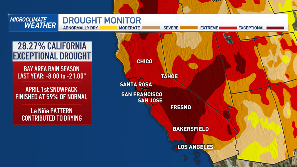
While our rain season started off strong with historic rainfall in October, we’ve been under a dry spell recently as our drought continues with 28.27% of the state under the worst drought category. So, where’s the rain? Chief Meteorologist Jeff Ranieri has more.
While our rain season started off strong with historic rainfall in October, we’ve been under a dry spell recently as our drought continues with 28.27% of the state under the worst drought category. So, where’s the rain?

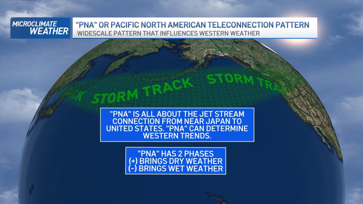
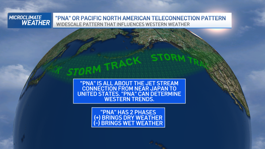
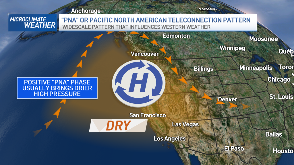
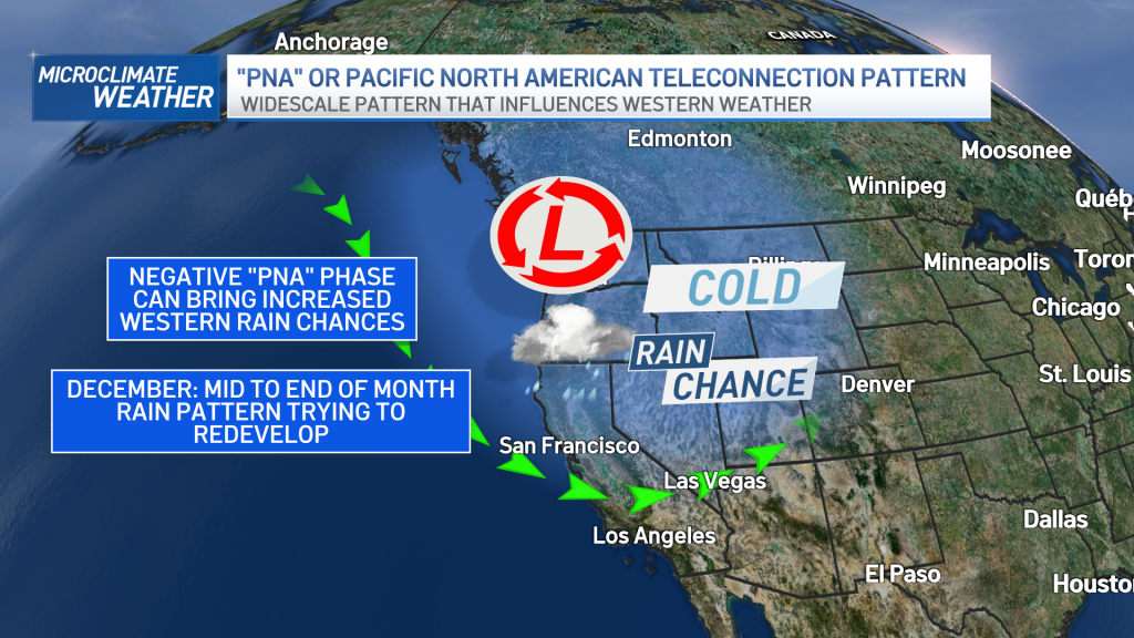
Something called “PNA” or Pacific North American Teleconnection Pattern could have some answers for our current weather pattern that’s kept us in a dry trend over the Bay Area. While we often show the 7 day forecast, we are always looking well beyond that with different forecast models to see any changes in trends. “PNA” is all about the jet stream connection from near Japan to the United States and can help determine our Western weather trends. What we look for in “PNA” is a (+) positive phase, which can bring dry weather or (-) negative phase, which can bring wetter weather.
Get a weekly recap of the latest San Francisco Bay Area housing news. Sign up for NBC Bay Area’s Housing Deconstructed newsletter.
Most recently we have been in a (+) “PNA” phase and this has brought on & off strong high pressure for weeks and no storms.
The good news, “PNA” is now showing signs it would trend more (-) and signal the return of more rain chances that could make it to the Bay Area. While it’s still too early on any totals, it does look like the mid to end of December may be looking up for us on rain chances. We’ll keep you updated in the weeks ahead.
You can find out more about our changing climate and all of our stories in this link.

