
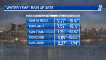
This winter has been anything but normal as our Bay Area drought continues to grow. Since the start of our rain season in October, we have really struggled to get storms moving across the Bay Area. Take a look at the numbers below and you can see we are running -7.94 inches to 18.47 inches behind for the rainfall season.
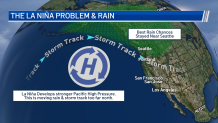
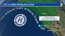
So, what was the big problem with getting rain? It’s all about La Niña. When we have La Niña developing over the Pacific, this is a cooling of the Pacific waters. Overall, this can result in the storm track modifying and pushing more north towards Seattle and keeping rain away from the Bay Area. This is the exact pattern we were stuck with for much of winter.
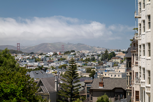
Get a weekly recap of the latest San Francisco Bay Area housing news. Sign up for NBC Bay Area’s Housing Deconstructed newsletter.
So, why weren’t we dry all of winter? Well, at times during La Niña, the storm track can still dip to the south (see graphic below), but it’s usually not a pattern strong enough to yield several storms in a row. These storms also don’t usually hold as much rain as they move over quite a bit of dry land before reaching the Bay Area. Additionally, this setup will funnel in quite a bit of cold air since the pattern is pushing down more directly from the north. This is the exactly how our winter rain season played out the past few months.
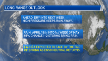
What’s next? Dry weather looks to stay for the last week of March, but I am calling for a 65% chance of one to two storms by the end of April into early May. As for La Niña, this is expected to fade by the end of spring with ENSO neutral conditions returning.
You can find out more about how the Bay Area climate is changing in a series of stories the Microclimate Weather Team worked on.