
A series of storms slamming the Bay Area Wednesday and Thursday triggered widespread flooding, power outages, downed trees and other storm-related problems across the region.
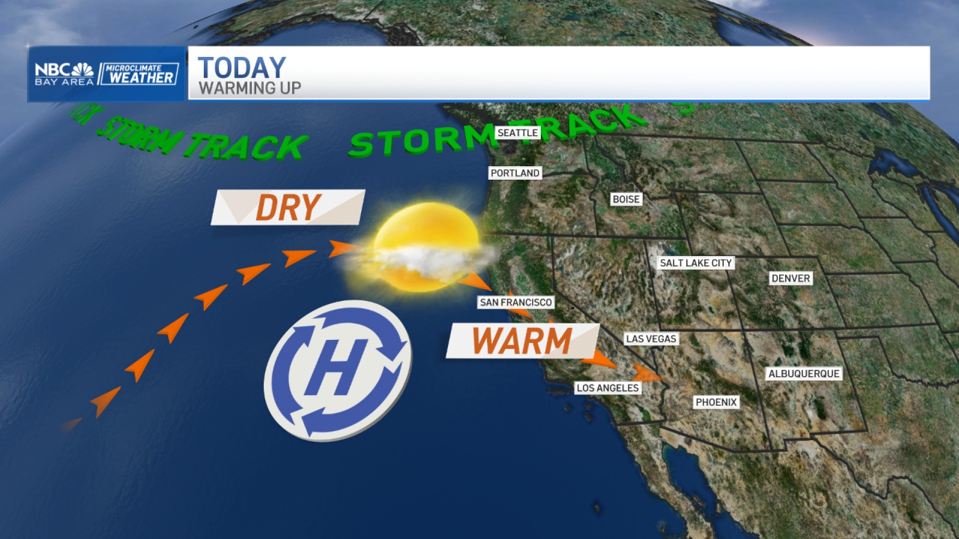
The latest wave of rain from an atmospheric river began Wednesday and continued Thursday. The entire Bay Area was under a flood watch due to the heavy rain. A dire forecast update from the National Weather Service earlier this week said the storm will be as bad or worse than Saturday's deluge and one which will likely result in the loss of human life.
Get a weekly recap of the latest San Francisco Bay Area housing news. Sign up for NBC Bay Area’s Housing Deconstructed newsletter.
Flood Watches issued for entire Bay Area
Flood watches are in effect from Wednesday morning through Thursday afternoon for the entire Bay Area, with rain amounts expected to range from 2-4 inches in the valleys, 3-6 inches in the foothills and up to 8-10 inches in the coastal mountains.
View latest weather alerts at nbcbayarea.com/weather.
Widespread high wind warnings issued in Bay Area
A high wind warning is in effect from early Wednesday morning through Thursday morning, the National Weather Service said.
Visit nbcbayarea.com/weather for the latest weather alerts.
What's the timeline of the Bay Area storm and how much rain will fall?
Wednesday through Thursday morning will be the worst of the storm, with heavy rain and strong winds, with gusts of 35-55 mph in most areas and stronger gusts at higher elevations.
The latest forecast includes increased rain totals for several areas from a previous forecast issued Sunday:
- San Rafael (4-6 inches, up from 3-4 inches);
- San Jose (2-3 inches, up from 1.5-2 inches);
- Livermore (2-3 inches, up from 1.5-2 inches)
Two areas on the coast south of San Francisco may see slightly less rain than first forecast. The revised forecast is for 2-3 inches of rain in Half Moon Bay -- down from 3-4 inches -- and for 3-4 inches in Santa Cruz instead of 4-6 inches in the previous forecast.
What problems will the storm bring to the Bay Area?
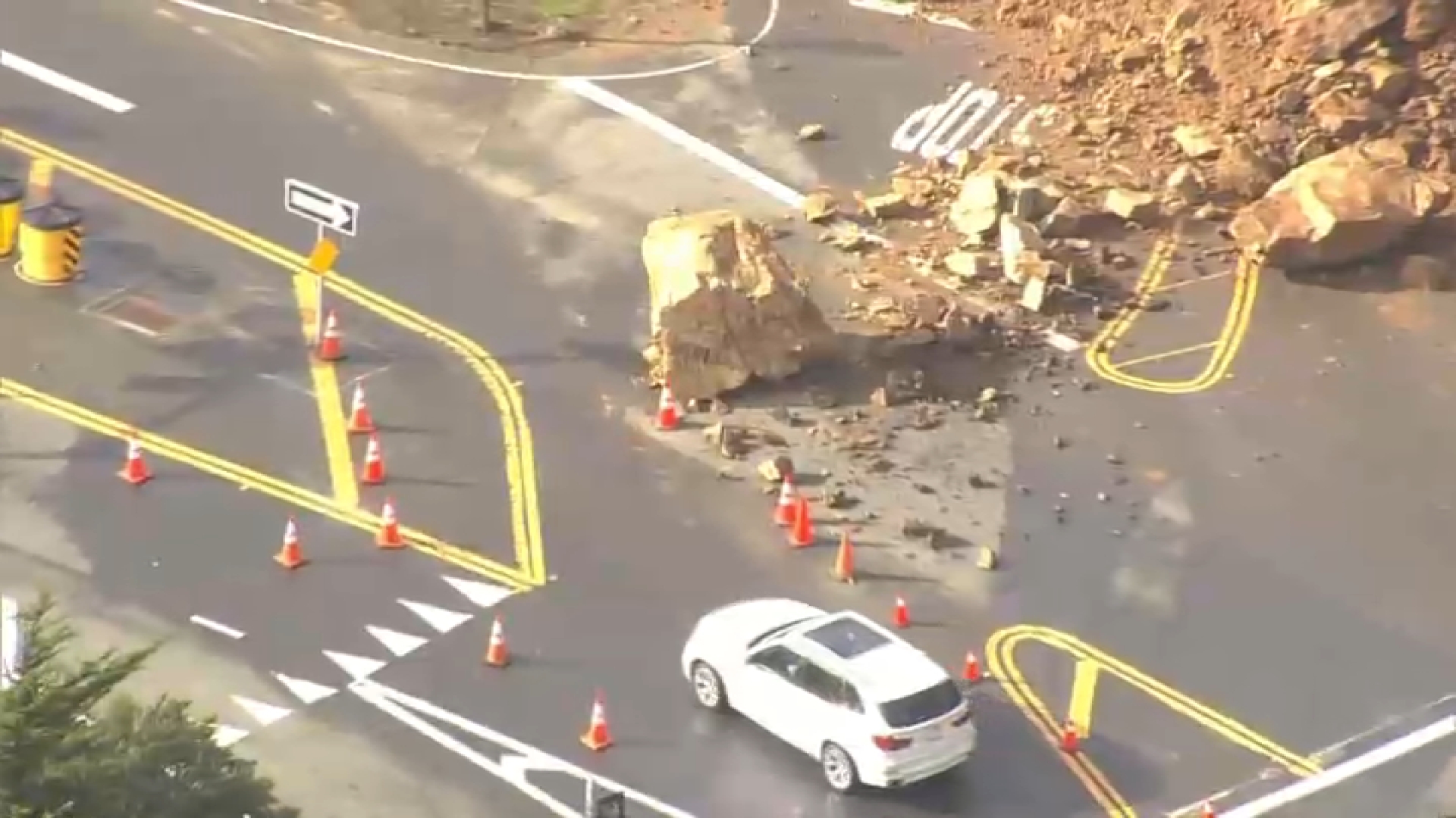
The NWS says to expect similar impacts to last weekend's storm that caused widespread flooding and damage. Soil will remain saturated to near saturated, meaning a higher risk of flooding and shallow mudslides.
The Bay Area can expect rapid rises in creeks and streams as well as "main stem" rivers that may approach or reach flood stage.
Strong winds with gusts of 35 to 55 mph, with stronger gusts in the mountains, could lead to downed trees and power lines.
The NWS update issued earlier this week includes five key points, with the first one noting a "threat to life likely during this storm." Mudslides are anticipated due to saturated soil, and rapidly rising creeks and streams will pose additional dangers.
A meteorologist shared the following observations in the forecast about the coming storm: "To put it simply, this will likely be one of the most impactful systems on a widespread scale that this meteorologist has seen in a long while. The impacts will include widespread flooding, roads washing out, hillside collapsing, trees down (potentially full groves), widespread power outages, immediate disruption to commerce, and the worst of all, likely loss of human life. This is truly a brutal system that we are looking at and needs to be taken seriously."
The forecast includes an updated threat matrix it classifies as "extreme risk" for conditions expected Wednesday and Thursday, including increased wind gusts, a flood watch that now includes the entire Bay Area and an added forecast Friday through Sunday after the big storm for roughly 1-2 inches of rain in most areas.
For the latest forecast updates, visit the NBC Bay Area weather page.
Use interactive radar to track the storm
Monitor current PG&E outages in Bay Area
The Associated Press and Bay City News contributed to this report.
