


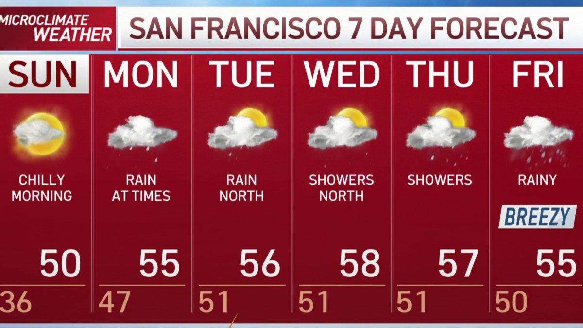
After a freezing start with inland temps in the 20s and 30s, we’ll see afternoon highs rebounding to the upper 40s and mid 50s on Sunday. Increasing clouds will wrap up the weekend with a few isolated showers or sprinkles at times across the North Bay mountains and coast before rain spreads back across the Bay Area on Monday. Unlike storms over the last couple of weeks, rain totals for this week are looking somewhat limited south of San Francisco, while areas in the North Bay could pick up 1”-2” by midweek.
Tide-poolers and beachgoers should keep an eye out for King Tides, the highest tides of the year, which are expected to cause minor flooding in some low-lying areas through Monday, according to the National Weather Service.
King Tides occur when tidal forces maximize as the moon, earth, and sun come into alignment, with the moon nearest to earth and the earth nearest to the sun.
Historically, the tides have brought flooding to low-lying areas around San Francisco Bay and some sites along the Pacific coast, such as near Elkhorn Slough near Moss Landing.
The King Tides will be followed later in the afternoons by the lowest low tides of the season, which could mean trouble for boaters in shallow waterways, forecasters said.
Get a weekly recap of the latest San Francisco Bay Area housing news. Sign up for NBC Bay Area’s Housing Deconstructed newsletter.
The King Tides are forecast to peak on Sunday and a coastal flood advisory is in effect until 10 a.m. Monday.
Local tidal data forecasts are available for several coastal and San Francisco Bay locations at www.tidesandcurrents.noaa.gov.

