Around the country, people rely on these piles of snow for their water supply. What is a snowpack, and how else does it impact you?
What to Know
California is coming off a fifth straight month of below-average snow and rainfall.
Unless March and April deliver a series of powerful winter storms, it appears the state is in for back-to-back dry years.
Northern California’s Lake Oroville is at 55 percent of average. Lake Shasta, the state’s largest surface reservoir, is at 68 percent of average for March 2.
The third snow survey of the season indicated California is headed for another dry year as the state closed out its fifth straight month of below-average snow and rain.
Unless March and April deliver a series of powerful winter storms, it appears the state is in for back-to-back dry years. January brought a glimmer of hope for the state's water supply, but not enough to make a significant impact.
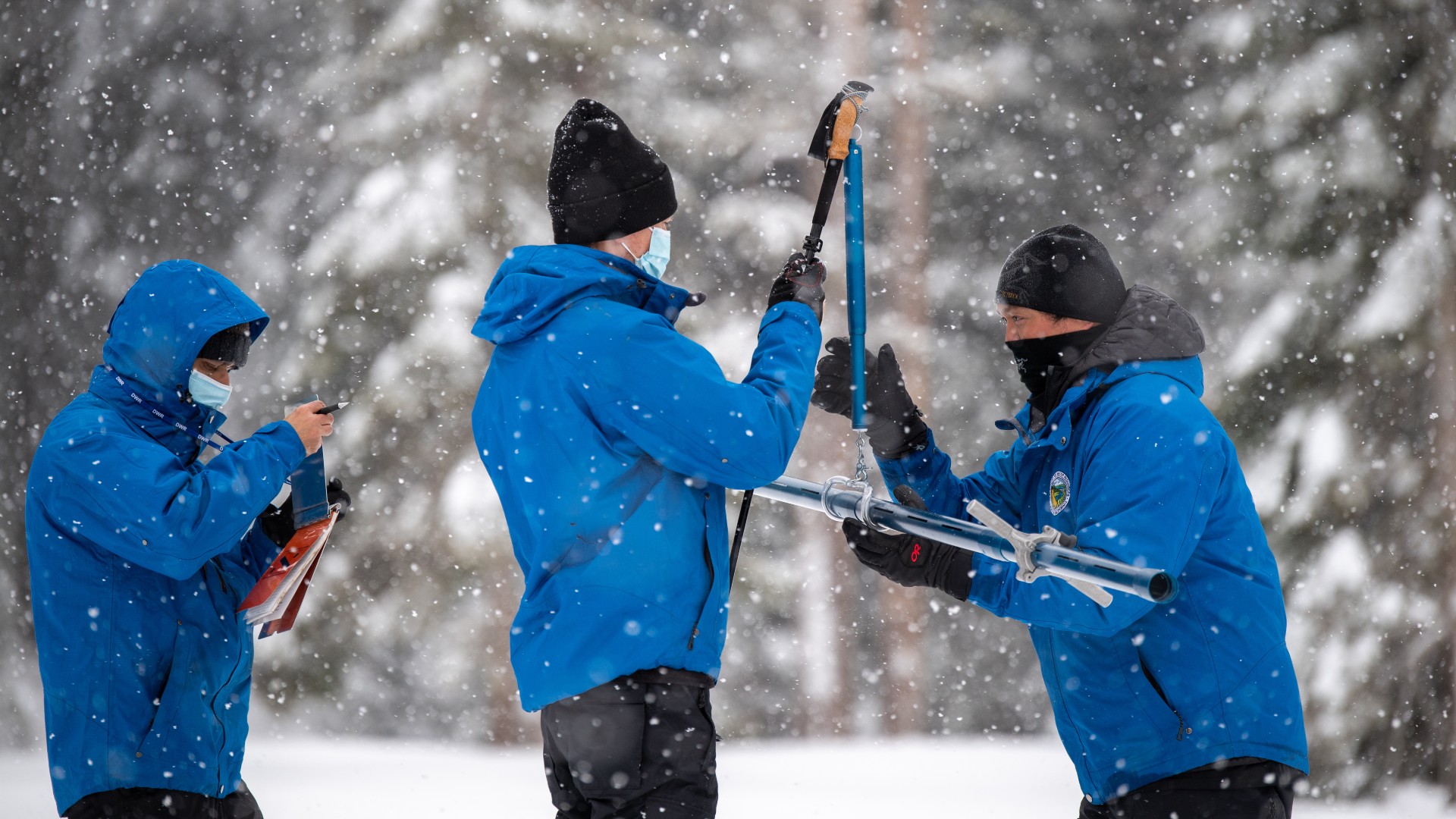
The third manual snow survey of the season on Tuesday recorded 56 inches of snow depth and a snow water equivalent of 21 inches, which is 86 percent of average for the location at Philip’s Ranch Station in the Sierra Nevada Mountains.
DWR today conducted the third Phillips Station snow survey of the season and dry conditions persist. The manual survey recorded 56 inches of snow depth & a snow water equivalent of 21 inches, which is 86% of the March average at this location.#snowsurvey2021#cawaterpic.twitter.com/c3oJw6tSqy
Snow water equivalent is the depth of water that theoretically would result if the entire snowpack melted instantaneously.
“As California closes out the fifth consecutive dry month of our water year, absent a series of strong storms in March or April we are going to end with a critically dry year on the heels of last year’s dry conditions,” said California Department of Water Resources Director Karla Nemeth. “With back-to-back dry years, water efficiency and drought preparedness are more important than ever for communities, agriculture and the environment.”
California’s water reservoirs are showing the effects of below-average precipitation. Northern California’s Lake Oroville is at 55 percent of average. Lake Shasta, the state’s largest surface reservoir, is at 68 percent of average for March 2.
The manual surveys are conducted monthly through April and, if necessary, May. The department also uses electronic monitors to gauge California's water needs. Those stations indicate statewide snowpack with a snow water equivalent of 15 inches, or 61 percent of the March 2 average, and 54 percent of the April 1 average.
California Department of Water Resources
The results of California's annual snowpack surveys in the Sierra Nevada Mountains have been mixed over the decades.
NBC10 Boston
The California Department of Water Resources conducts a snow survey to measure the snowpack in the Sierras in El Dorado County in Northern California. Photo taken sometime during 1958.
California Department of Water Resources
California Department of Water Resources snow survey team right, Ray Barsch and Christopher Carr cross country ski to the Alpha test site, 7600 feet elevation in the Sierra Nevada mountain range near Forni Ridge and Lyons Creek in El Dorado County north of U.S. Highway 50. The water runoff from this area is part of the American River Watershed in Northern California. Photo taken April 11, 1967. Paul Weber / California Department of Water Resources, FOR EDITORIAL USE ONLY
California Department of Water Resources
Center, Frank Gehrke, chief of the California Cooperative Snow Surveys Program for the Department of Water Resources prepares for the monthly snow survey at Phillips Station in El Dorado County in the Sierra Nevada mountains. Photo taken March 2, 2009.
Telemundo
Right, Frank Gehrke, chief of the California Cooperative Snow Surveys Program for the Department of Water Resources leads the way to conducts the monthly snow survey during a snow storm at Phillips Station in El Dorado County in the Sierra Nevada mountains. Photo taken March 3, 2010.
Kelly Grow / California Department of Water Resources
Frank Gehrke conducts California Department of Water Resources monthly snow survey at Phillips Station near Echo Summit on December 30th, 2014.
California Department of Water Resources
The mountains at Phillips Station near Echo Summit on January 3, 2014.
CADWR
Frank Gehrke (DWR Chief of Snow Surveys) addresses the media during a snow survey at Phillips Station on April 1, 2015. The black tag on the pole is where the snow was in the drought year of 1977, the yellow tag is where the snow was the year before, and the green tag is where the snow is on an average year.
The Department of Water Resources (DWR) conducts a snow survey at Phillips Station on April 1, 2015. Measurements in Phillips began in 1942, and this report marked the first time there was zero snow for an April 1 measurement. Below-normal precipitation, combined with unusually warm weather, produced meager snowfall during the traditional wet season.
California Department of Water Resources
Right, Frank Gehrke, chief of the California Cooperative Snow Surveys Program for the Department of Water Resources, conducts the monthly snow survey at Philips Station.
California Department of Water Resources
Members of the California Council on Science and Technology Science Policy Fellows left to right, Michael Peterson, Julianne McCall and Mikel Shybut assist Frank Gehrke Chief of the California Cooperative Snow Surveys Program with the second snow survey of the 2017 snow season at Phillips Station in the Sierra Nevada Mountains. The survey site is approximately 90 miles east of Sacramento off Highway 50 in El Dorado County. Photo taken February 2, 2017.
Dale Kolke / California Department of Water Resources
The third snow survey of the 2017 snow season at Phillips Station in the Sierra Nevada Mountains. The survey site is approximately 90 miles east of Sacramento off Highway 50 in El Dorado County. Photo taken March 1, 2017.
California Department of Water Resources
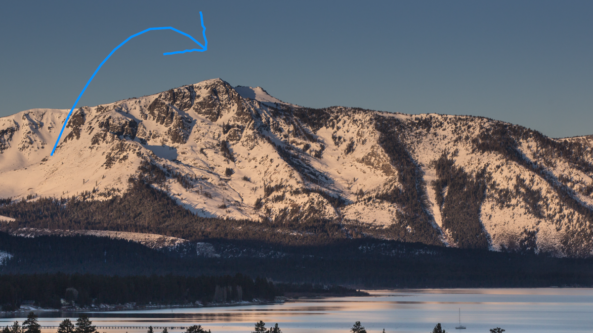
A snow-covered Sierra Nevada mountain peak to the northwest from the Phillips Station meadow where the California Department of Water Resources conducted its third snow survey of the winter 2017 season. Photo taken March 1, 2017.
California DWR
A view of the Phillips Station site on Jan. 3, 2018 before the first snow survey of the season.
California DWR
A view of Phillips Station in the Sierra Nevada Mountain Feb. 1, 2018 during the second snowpack survey of the year.
CA DWR
A view of Phillips Station in the Sierra Nevada Mountains ahead of the third manual snow survey of 2018. The same meadow had just 7 percent of its usual snowfall a couple of weeks ago. A big winter storm a week earlier brought that up to 39 percent.
California Department of Water Resources
Frank Gehrke, Chief of the California Cooperative Snow Surveys Program leads the way to conduct the fourth snow survey of 2018 at Phillips Station in the Sierra Nevada Mountains. The survey site is approximately 90 miles east of Sacramento off Highway 50 in El Dorado County. Photo taken April 2, 2018.
California Department of Water Resources
John King, Water Resource Engineer, of the California Department of Water Resources, prepares to insert the long aluminum snow depth survey pole into the snow for the third media snow survey of the 2019 season at Phillips Station in the Sierra Nevada Mountains. The manual survey recorded 113 inches of snow depth and a snow water equivalent of 43.5 inches -- more than double the previous month.
California Department of Water Resources
John King, Water Resource Engineer, DWR Snow Survey Section, leads the fourth snow survey of water year, followed by team of members of DWR's excecutive staff. The survey showed snow water equivalent at 200 percent of average for the site.
California DWR
The third snow survey of the season is conducted March 2, 2021.
California DWR
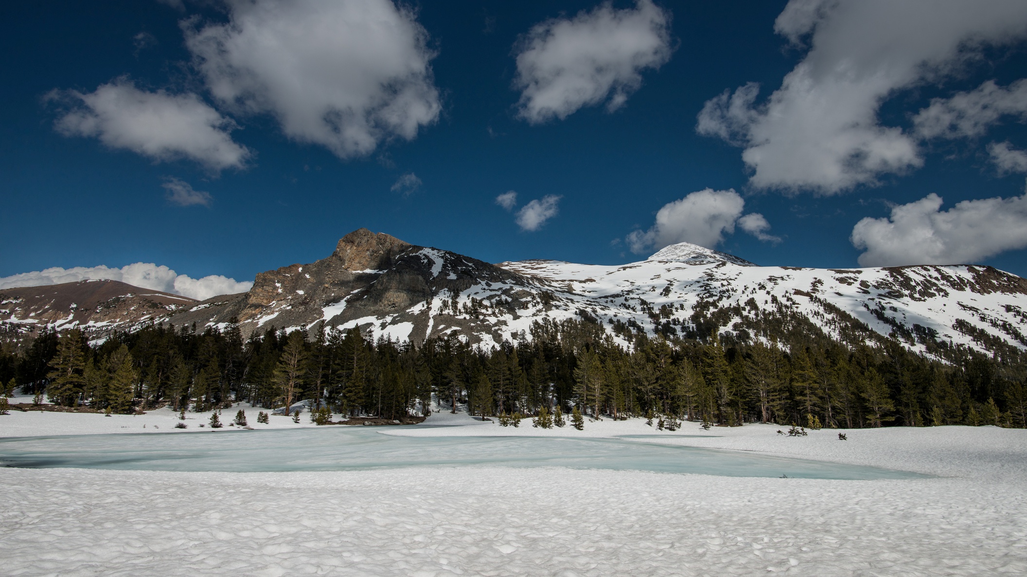
California’s Jan. 3, 2023 snow survey in the Sierra Nevada Mountains.
April 1 is typically when California’s snowpack is at its most robust.
The snowpack is a critical element in the water supply of the nation’s most populous state. The snow melts in the spring and summer months, replenishing the state’s water reservoirs.
Last year at the end of January, California was at 73 percent of average. The year before, California recorded its fifth-deepest snowpack.
The snow survey results can vary wildly. At the height of California’s most recent years-long dry spell in 2015, then-Gov. Jerry Brown found himself standing in a field of brown grass with no signs of snow.
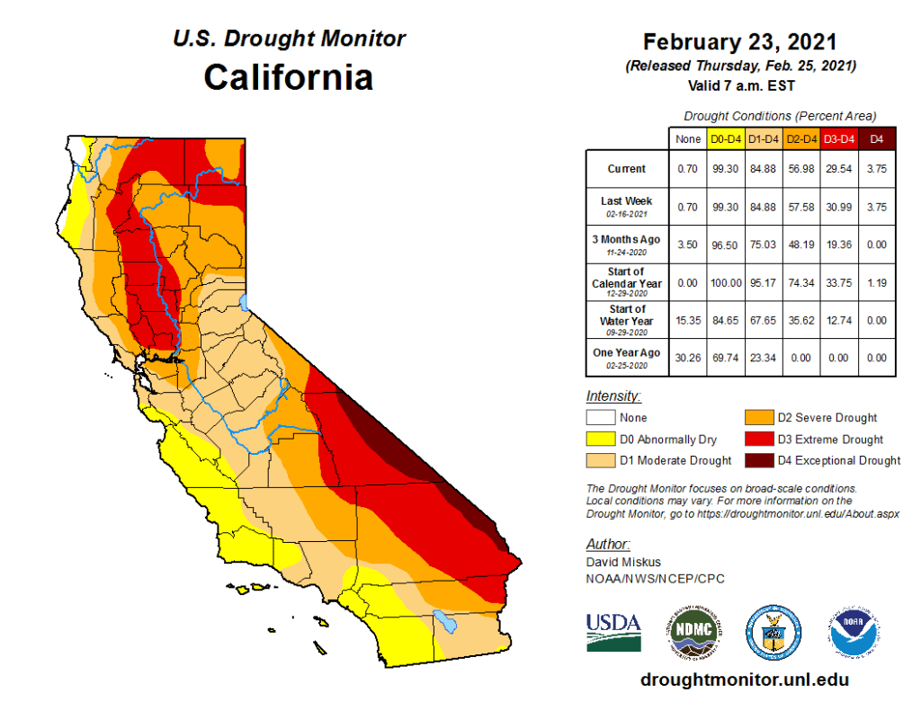
This U.S. Drought Monitor map shows conditions Feb. 23, 2021.
The U.S. Drought Monitor report issued Feb. 25 showed nearly 30 percent of California in extreme drought — the fourth most severe level of drought in the Monitor’s five categories. Eighty-five percent of the state was in moderate drought.
The driest conditions appeared in the extreme eastern part of the state along the Nevada border and parts of Northern California.