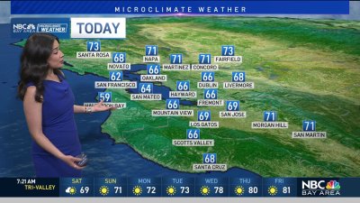
AM Freeze, PM Showers & Low NorCal Snow
Morning temps in our wind-sheltered valleys may approach some records with mid 20s to lower 30s through 9am. Depending on the arrival of mid and high level clouds, today’s high temps may manage a rebound into the 50s or for areas seeing increasing high clouds (especially North Bay) highs may be stuck in the 40s as the clouds prevent much warming from our chilly morning.
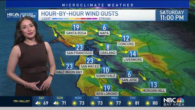
Showers will increase into the afternoon and evening, especially to the north. As a fairly cold weather system, rain totals are expected to be fairly low (trace amounts or zero to .33″) but snow levels could get interesting overnight into Monday.
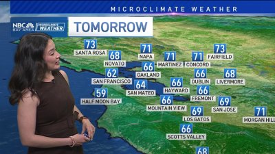
Lake County northward into the upper Sacramento Valley may see snowfall (near the Chico/Redding area) and if any stronger cells develop along the frontal passage some mixed precip, sleet showers will be possible. Best odds look to be in the North Bay for this so stay tuned, otherwise skies should clear fairly rapidly into Monday afternoon as high pressure rebuilds on the West Coast.
This high should hold its ground through New Year’s Eve before the jet stream tries to undercut the ridge and send increasing rain chances aimed at Central and Southern California by the end of the weekend. – Rob Mayeda