Meteorologist Kari Hall tracks an incoming atmospheric river storm set to arrive Wednesday with expected impacts in the Microclimate Forecast.
Sunny skies and warm temperatures will give way to wind and heavy rain this week as an atmospheric river makes its way to Northern and Central California from the tropical Pacific Ocean.
Monday will be characterized by temperatures in the upper 60s to mid 70s in most places, with low 80s possible in the Santa Clara and Salinas valleys, according to the National Weather Service.
Clouds are expected to move across the region Tuesday, with rain arriving in the North Bay late in the evening hours and progressing across the entire region Wednesday.
Get a weekly recap of the latest San Francisco Bay Area housing news. Sign up for NBC Bay Area’s Housing Deconstructed newsletter.
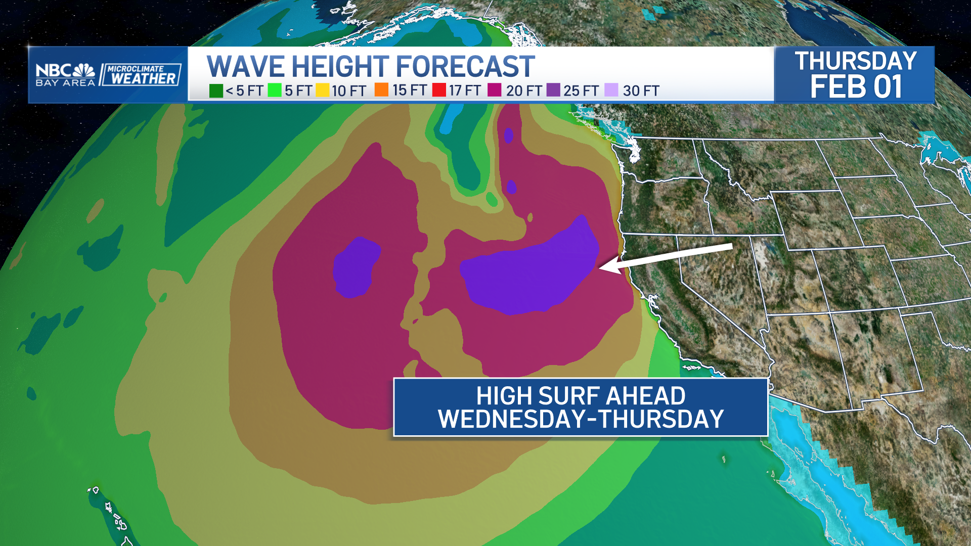
"The biggest impacts are going to be in our normal wet spots like the North Bay coastal mountains, along the Santa Cruz Mountains and the Santa Lucias in Monterey County," said National Weather Service meteorologist Rachel Kennedy.
A flood watch will also be in effect for the Bay Area and Central Coast from 4 a.m. Wednesday to 4 a.m. Friday.


The highest rain totals are expected in the North Bay, with 4 to 6 inches possible in and around Cloverdale and potentially higher amounts in the coastal mountains, Kennedy said.
Weather


The rest of the Bay Area will likely see 1 to 3 inches of rain, with higher totals likely at higher elevations.
This round of storms will also be accompanied by strong winds of 30 to 40 mph coming from the south, with possible gusts of up to 60 mph at some coastal areas and along ridgetops.
The forecast also calls for the possibility of rapidly rising rivers and streams, with some possible flooding, as well as downed trees, power lines and broken branches.
"The soils are still fairly saturated and we're not anticipating that they'll dry out enough to prevent the risk of shallow landslides," Kennedy said.
After Wednesday, the somewhat slow moving system will pick up speed as it heads out of the region but showers are expected to linger through Saturday, with more rain possible Sunday.