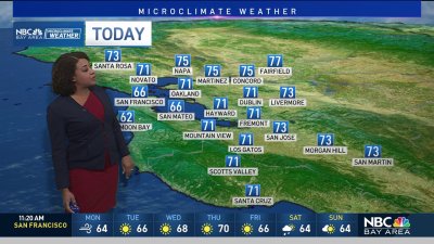
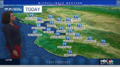
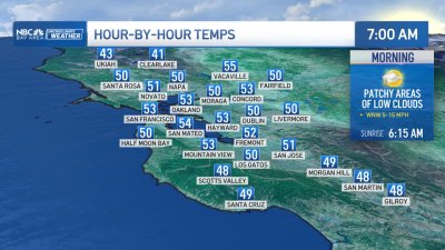
Chilly Mornings Continue
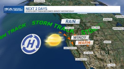
SUNDAY: Some patchy frost possible again to start the day with temps climbing into the mid 50s to low 60s for the afternoon under a mix of high clouds and sunshine. Sunday night temps should be a little more mild as winds briefly shift slightly more onshore, adding moisture to the air and preventing lows from dropping to frosty levels again.TUESDAY: WINDY & A SLIGHT CHANCE FOR SHOWERSA cold front dropping down from Western Canada will drop into the Bay Area early Tuesday. While moisture will be limited, the bigger impacts here are expected to be gusty winds approaching 40 mph+ in the hills and daytime highs running a few degrees cooler than this weekend’s chilly temps. Snow levels will be quite low with this system however given the inland path from north to south over Northern California, its still looking like most of the snow showers down to 2-3,000 feet will be over the Sierra and south to the Grapevine I-5 leading into Southern California. As winds subside heading into the New Year, the airmass over the Bay Area will be quite dry, possibly dry enough to allow temps at least as cold as the weekend mornings and possibly even lower.