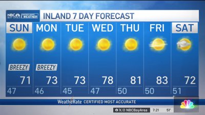
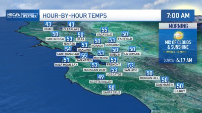
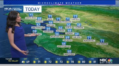
Cold Start To Tuesday
Patchy areas of frost are likely especially in wind-sheltered valleys to start the day in the North Bay, East Bay and areas away from downtown San Jose in the South Bay. Temps should rebound to the mid 50s to low 60s as high clouds pass by at times. Temps should trend slightly milder through midweek with rain chances on the increase late Friday into the weekend. The weather models seem to be aligning on a pattern shift to cooler, showery weather at times through the holiday weekend with lowering snow levels, so plan on Winter driving conditions to Tahoe, Shasta and possibly south on I-5 into Southern California. We could see lowering snow levels across the higher mountains here too, pending how much moisture these fast moving systems bring with them dropping out of the north into early next week…so stay tuned.