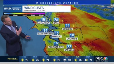
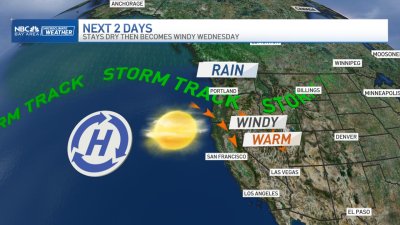
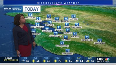
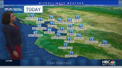
Cooler & Breezy Changes
After a weekend of record high temps, a cooling trend starts the work week with a slight chance for morning drizzle or light rain in a few spots by Tuesday morning.A weakening weather system will increase cooler NW winds off the ocean dropping temps into the 60s and 70s for Monday and a few degrees lower by Tuesday. There may be enough moisture and lift left with this system as it moves through Tuesday morning to bring some areas of drizzle or brief light rain. By Tuesday afternoon, skies clear and winds pick up into the 20-30 mph range. Dry conditions and slight warming is expected for the second half of the week then next weekend we have a better chance for some showers as a cool trough drops in over the region.Depending on the placement of this trough we may see scattered showers and isolated thunder by Sunday, or merely cool and breezy conditions with moisture closer to the Sierra if the system slides up and over us to the east. Stay tuned, hopefully we can manage some rain next weekend!- Rob Mayeda