December Sunshine
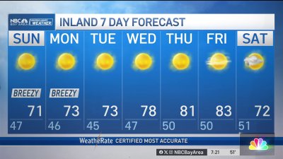
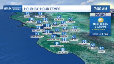
It still feels like Winter with our morning temperatures in the 30s and 40s, cold enough for frost or patchy ice in our interior valleys however by day you should be able to notice some warmer weather into early next week.High pressure will strengthen into Monday boosting most of our temps into the low to mid 60s by the end of the weekend and closer to some 70s near Santa Cruz and the South Bay for Monday.Cooling and more clouds will return by midweek, followed by another round of chilly weather for the second half of the week as the high recenters itself just slightly more to our west. This will allow a couple of colder systems to move down from British Columbia down into Northern California. This will limit how much moisture these systems will have to work with so while showers are not expected locally (though likely over the northern mountains and Sierra) we will see our highs drop back into the 50s approaching next weekend with blustery winds out of the north. This may set us up for more freezing temps again by next weekend as well. In the meantime, enjoy the daytime warmer weather into next week!