From Sun to Showers
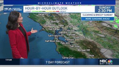
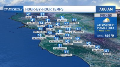
It’s going to be pretty tough to top Saturday s gorgeous weather around the Bay Area though at least to start Sunday will come close for areas in the South Bay. On the horizon however is a strong storm system that has produced a damaging wind gusts and several inches of rain to the Pacific Northwest that will slowly drop southward toward the Bay Area. Thankfully, this system is weakening rather rapidly as the cold front begins to approach us later in the evening however this will add increasing lift and moisture to areas especially north of San Francisco by mid afternoon, good enough for increasing shower chances.The system should move through during the day Monday as the frontal boundary essentially begins to stall and weaken over the Bay Area, keeping a chance for showers and mainly cloudy skies into early Tuesday morning. By Tuesday afternoon we ll see clearing skies as we transition back into a warming, dry and breezy finish to the week that will see temps rebound into the 70s and 80s near the coast and bay with mid to upper 80s inland. Depending on the strength of the winds in the hills Thursday into Friday, we may see Red Flag warnings issues again for the hills later in the week.Enjoy your Sunday!Rob Mayeda