High Fire Danger Ahead
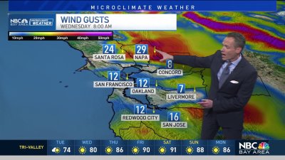
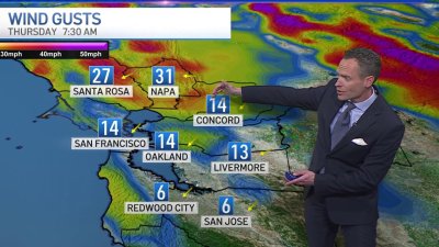
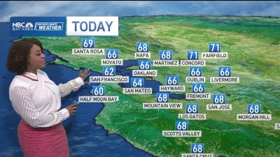
Sunday will see a storm system passing by to the north, briefly increasing clouds and even a slight chance for showers into the far North Bay, though best odds will stay north of Mendocino County. We’ll see clearing into the afternoon with winds increasing into Monday and Tuesday. This same weather system will drop down and stall into SoCal, as high pressure builds up and over Northern California producing a round of dry, north to offshore winds into Wednesday. A Fire weather watch will be in effect late Monday into Wednesday for the hills of the North Bay and East Bay and bears watching. At this point, sustained wind speeds may not quite reach red flag criteria, though the North Bay hills will probably see the highest wind speeds generally into the 25-35 mph range. Temps will soar through midweek with some mid and upper 90s possible (if not slightly hotter) esp. in some wind sheltered areas in the valleys, but temps will quickly crash down as a November-December like storm system drops down the West Coast approaching next weekend. Highs in the 60s and 70s look likely with shower chances and probably Sierra snow as well if things line up the way the extended weather models are suggesting so stay tuned.