Mild Weekend, Chilly Changes Ahead
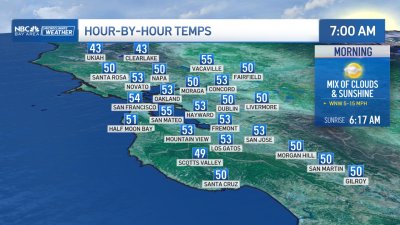
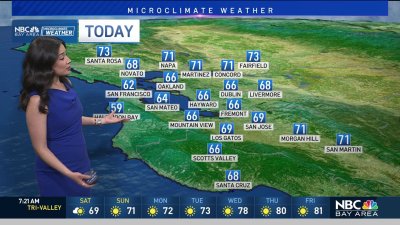
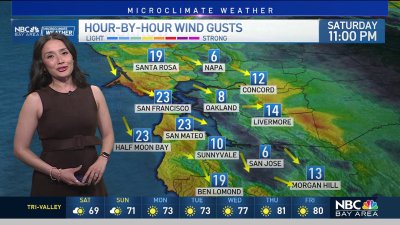
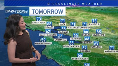
SOME AM FOG, WARM DAYS FOR LATE NOVEMBER!Looks like a subtle onshore push will allow some marine air to spill under the dry air / warm inversion aloft. This should yield some areas of low clouds and patchy fog though mid-morning trending clear with hazy sunshine by the afternoon for both Saturday and Sunday. Temps will likely reach the mid 60s to even mid 70s in range for the warmest inland locations to wrap up the weekend.WINTER BLAST AHEADTemps look to dive in the opposite direction starting Tuesday as a strong yet mainly dry Canadian cold front plunges into the Bay Area. Winds will increase behind the front from 15-30 mph and much cooler air will being pouring in. Highs will drop into the 50s from Tuesday and beyond with wind-sheltered valleys seeing the potential for freezing temps for a few hours overnight. A freeze warning for the valleys seems likely as winds begin easing off into Wednesday night and Thursday. With this much cold air in place, not too much in the way of moisture is expected, however if this system tracks slightly more to the west and manages to scoop up more maritime polar (cool, yet moist air) air then we may see scattered showers and possibly some snow showers to near 3,000 ft. at times, more so near the Sierra where more moisture will be moving by to our east. Enjoy your weekend! Rob Mayeda