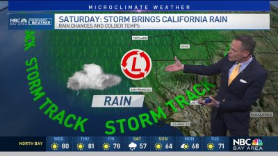
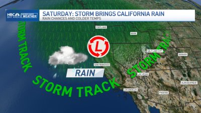
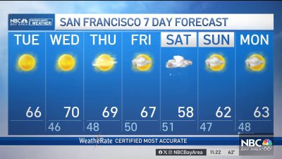
Next Storm Arrives Thursday
Our break between storms may still include a few showers and areas of light rain esp. near the coast and North Bay hills. Skies should turn increasingly cloudy into the evening as a cold weather system spins down the coast. Highs will be mainly in the mid 50s with winds increasing out of the south by evening. CHRISTMAS EVE THURSDAY:
Gusty winds and briefly heavy rain will start things off during the morning, then behind the front around midday we will begin to see some clearing as rain changes to scattered showers and isolated thundershowers at times. With freezing levels near 3,000 ft. stronger convective showers will have no problem generating small hail or ice pellets at times. This colder air sweeping in will allow for snow levels to 2,500 feet overnight however moisture will be decreasing around this time. There’s still that opportunity at least for parts of the Bay Area to see a white Christmas as skies clear Friday morning.
Cold temps with likely frost or freeze warnings will be the trend of the weekend with mainly dry conditions until Sunday morning before another relatively weak system brings a chance for more showers our way, possibly again with some pretty low snow levels with cold air trapped in some of our higher elevation interior valleys.