October Heat Wave
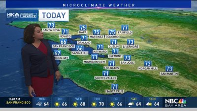
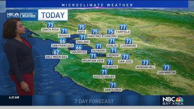
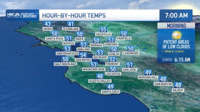
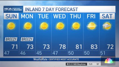
A Summer-sized ridge of high pressure will bring offshore winds that will act a bit like an atmospheric hair dryer across the Bay Area today…even to the coastline.Highs will soar into the mid 80s to upper 90s from Pacifica to Pleasanton with similar temps expected into Saturday as we await the return of onshore winds which should begin to cool down the coastline for Sunday and inner bay locations by Monday. Remember to stay hydrated and never leave pets, children, or anyone in a parked vehicle even with the windows slightly down. In a matter of 5-10 minutes temps can rise to 120-140 degrees creating a deadly situation. Hopefully as the marine layer builds and sea breeze returns early next week we’ll see some heat relief. – Rob Mayeda