Series of Storms Ahead
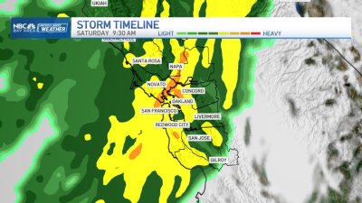
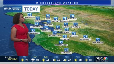
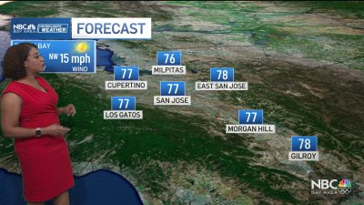
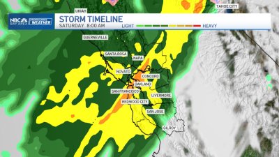
A strong jet stream aiming in on Southern California will help to dislodge high pressure bringing dry weather to start 2016. The net result will be a series of fast moving weather systems bringing rain to the Bay Area, and cool enough to keep snow going strong in the Sierra esp. for elevations above 5,000 ft. Rain should become more widespread for Sunday into the afternoon and evening changing over to showers for Monday. By Monday night, what may be the wettest storm in the series arrives for early Tuesday, again changing to scattered showers into the afternoon. More showers are due on Wednesday, before yet another system moves in for Thursday will locally gusty conditions. A brief break is expected for Friday into Saturday with a few scattered showers before the rain fills in again by next Sunday. All in all, we should be able to erase some NorCal rainfall season to date deficits of 30% to 40% below average — and boost the Sierra snowpack possibly to 150% of average by the end of next weekend.