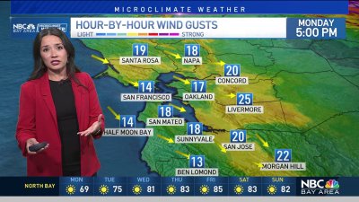
Showers Continue
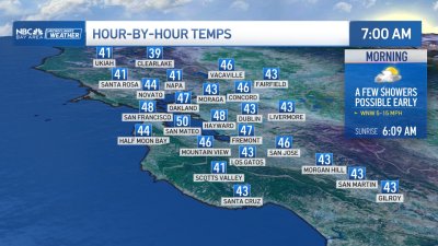
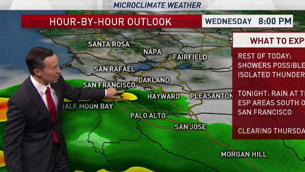
Another band of rain with a slight risk of brief thunder especially near the coast will move back into the region from south to north tonight. This band of moisture is on the north side of a low pressure system dropping into SoCal, so best odds for more rain will probably be to the south of San Francisco, more so near Santa Cruz and San Jose south. Temps remain cold enough for some snow at times near 3,500-4,000’ ft as well.
So what started as a White Christmas near Lick Observatory could see a little more snow overnight before skies clear again on Thursday.
Showers will end by early Thursday morning across the southern areas with some patchy frost possible in the North and East Bay valleys, and more frost likely for Thursday night into Friday morning. The forecast into next weekend is trending drier, with our next chance for showers arriving later Sunday night into Monday morning, though totals look quite a bit lower than recent storms. New Year’s Eve is also trending dry with slightly warmer temps early next week.