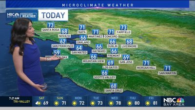
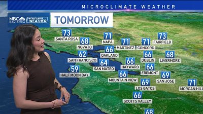
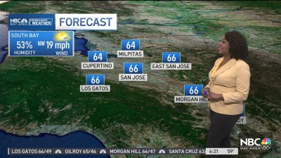
Some Showers and Cooler Temps Ahead
An upper level low will move roughly parallel to the coastline increasing chances for seeing some showers especially over the coastal range and interior mountains through midweek. While moisture is somewhat lacking there should be enough of it combined with daytime heating to allow clouds to build over the mountains. The best chances for seeing showers appear to be over the North Bay hills, mountains in Napa and Sonoma counties and especially further south, closer to the cooler air pool aloft associated with the area of low pressure. This means the Santa Cruz mountains and the Diablo Range south in the East Bay may see the greatest chances for showers, especially on Wednesday. We may also see a brief thundershower as the drifts by the Big Sur coastline before diving into Southern California.As the low moves out later on Thursday, shower chances will move southward with it. However, it looks like a weakening weather system arriving later on Friday will have enough left to it to bring a chance for more widespread shower or light rain to the Bay Area late on Friday into early Saturday.The weekend does look better with warming temperatures and clearing skies for Sunday into Monday.Enjoy your week! – Rob Mayeda