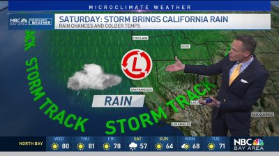
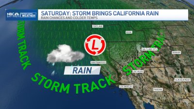
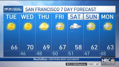
Tracking Midweek Storm
TUESDAY: More patchy thick fog may kick off the morning, as the Bay Area sees the last of the ‘quiet’ weather for the week. With strong winds and heavy rain expected, Tuesday would be a good day to clear branches, leaves, debris from drains. Highs may climb slightly as a southerly flow develops ahead of our midweek storm with highs in the mid to upper 60s.WEDNESDAY-FRIDAY: Its looking more likely we’ll experience a triple threat out of this next storm system which could come in as one of the strongest in years (especially given how dry our weather has been over the last couple of years). Subtropical moisture will be fired into the coastal hills by low level and upper level winds at a near perpendicular angle – ideal for high rain rates via “mountain-forced” atmospheric lift. However to start, wind may be more of the widespread issue as wind speeds begin to accelerate to 20-30 mph out of the S/SW with gusts nearing 50 mph+ for the coast and hills. Saturated ground with these wind speeds will likely cause tree damage especially on our hilltop and mountain highways. Drivers should use extreme caution when travelling in these locations for possible mudslides as well during the day Thursday. The heaviest rain should sweep out of the North Bay after midnight Wednesday and into the central Bay Area by the Thursday AM commute. Roadway/onramp and localized flooding appear likely. The current trend is to move this heavier rain band through the South Bay by the evening commute, allowing enough time for 2″-4″ of rain to fall for the cities and valleys with numbers possibly double those totals in the mountains by evening.