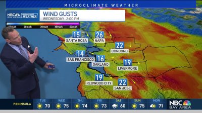
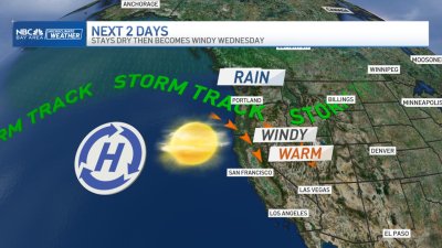
Videocast: Mild and More Clouds, Showers Later
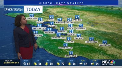
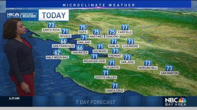
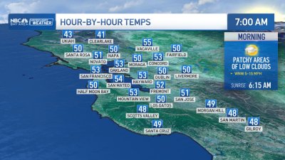
Another chilly start and another mild finish to the day is expected around the Bay Area – especially for locations in the South Bay where highs will climb well into the 60s and possibly hit the 70s in a few spots down near Morgan Hill and Gilroy. One change from Saturday will be increasing high clouds for the mid-afternoon and evening hours as we change over to mostly cloudy skies overnight. Its looking like we’ll manage at least some rain for parts of the North Bay early on Monday and depending on just how much low level moisture is in place we may wring out some drizzle/sprinkles around the rest of the Bay Area for your Monday morning commute. Skies should clear again behind this weather system by Monday afternoon before another fairly weak system tosses a chance for some light showers/sprinkles later on Tuesday. The rest of the week should see some warming temperatures with a few passing clouds as high pressure keeps things dry to start next weekend. Long range it does look like there is something of a pattern change developing with a large area of low pressure forming in the southern Gulf of Alaska that should start re-directing incoming moisture and storm systems across the West Coast again around the 8th-10 of February. This pattern would need to see the large West Coast ridge of high pressure ‘undercut’ by a strengthening jet stream/moisture feed moving across the Central Pacific. This is still a long way’s off, but hopefully will give us a chance to gain ground on some rainfall and snowpack deficits around the second week of February. But back to the present, hope you enjoy your Sunday! – Rob Mayeda