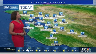
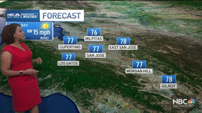
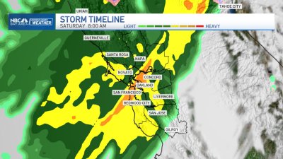
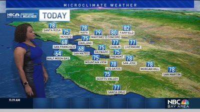
Warm Sunday, Midweek Showers Ahead
Sunday and Monday are shaping up to be the warmest days of the week as high pressure begins to give way to a stronger sea breeze, and eventually an area of low pressure approaching the coast by midweek. Temps will range from the 60s and 70s near the coast, with 70s and 80s inland for Sunday. Temps should begin trending cooler for Monday as onshore winds increase, and more cooling by Tuesday and Wednesday as clouds and onshore winds ramp up. Temps will drop below average midweek, and similar to last Wednesday’s system scattered instability showers could be the trend from Wednesday into the start of next weekend. While most of the showers are expected to initially be along the coastal range, higher hills and Sierra, all areas should have a decent chance for showers at times and isolated thunder later this week so stay tuned.