Rob's Forecast: Fog & Showers to Start the Weekend
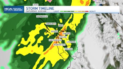
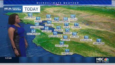
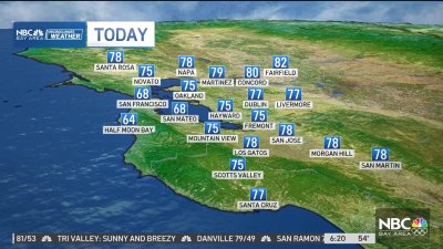
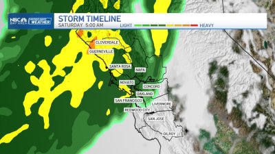
Lingering showers or light rain will be possible at times today as mostly cloudy skies continue over the Bay Area. The source of this moisture streams back to north of Hawaii, that’s adding extra water values to the air rising up/over the mountains which is providing a little extra boost to wringing out the showers and light rain at times. A high surf advisory continues through Sunday with larger sets and breakers in the 20-25 ft+ range, so keep clear of the beaches if possible esp. along those west-northwest facing shorelines. We may briefly see some of this shift farther north on Sunday before the first in a series of storms moves through the Bay Area. Monday should see much higher rain totals than what we’ll be seeing this weekend. Most areas should see at least 0.25″ to 0.75″ for Monday with higher totals likely across the coastal and inland mountains where 1″-2″ is possible. Another storm will move through Wednesday with what looks to be a third around Friday. This should help recover some of the rain/snowpack deficits we’re seeing across the state, however these atmospheric river boosted rain rates per hour will have to be watched closely along the burn scar zones for potential runoff and debris flows as well, especially later in the week as the ground gets more saturated.