Wild Weather Swings Ahead
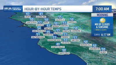
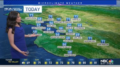
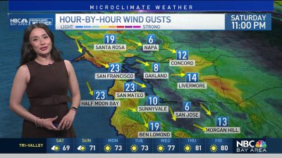
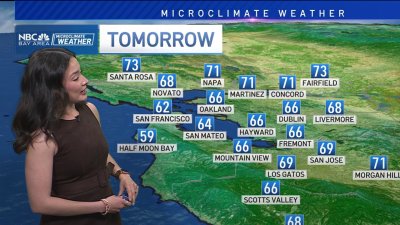
Two weather systems will impact our weather in different ways this week. The first moving inland Monday night into Tuesday may bring a few showers as far south as Ukiah early on Tuesday while the Bay Area sees a mix of low clouds and some spotty drizzle. Clearing and breezy conditions are expected into the afternoon with highs running cooler than Monday mainly 60s and 70s across most of the area with some lower 80s well inland.High pressure builds back quickly from Wednesday into Thursday allowing valley temps to climb +10 for Wednesday good enough for some 80s to low 90s. Things get interesting around Friday as a stronger system drops a little further south bringing a late day chance for showers into far northern Sonoma County and quite possibly across the Bay Area for early Saturday morning. The models are 50/50 on the rain progression with the general consensus going for showers down to SF with the drier model run keeps the showers Sonoma County northward. In either case, temps will cool considerably into the 60s and 70s for highs from Friday-Sunday and eventually usher in cooler air aloft that may help drop morning temps into the 40s and 50s early next week. If you think it feels like Fall
youre right Fall officially begins on Sunday.Rob Mayeda