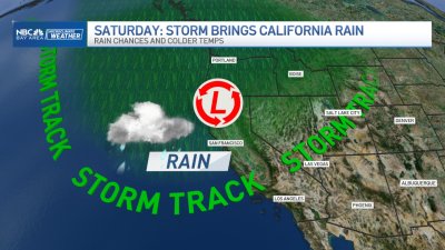
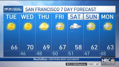
Winter-like Weekend Ahead
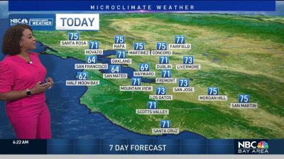
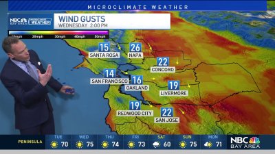
Ch-ch-changes are here. Look for a much cooler, breezy afternoon under partly cloudy skies and highs mainly in the 50s to lower 60s. There will be a few isolated showers possible in the far North Bay but chances for rain will mostly hold off until midday Friday. Starting Friday we’ll see some rain pushing into the Bay Area with continued cooling – highs dipping into the 50s for most and cooling even more for the weekend. The weekend forecast is looking very interesting – we’ll see rain off/on (not non-stop rain but ‘batches’ of rain at times) increasing winds (as a surface low forms and brushes to the north of us Saturday night) and snow levels lowering to near 2,500 feet by the end of the weekend. We may even manage a brief thundershower or two as very chilly air aloft meets up with some warmer/moist air below. These chances increase even more if we manage more sunshine at times Saturday/Sunday as surface heating (ground warming) will help destabilize the atmosphere even more. Given the low freezing levels – good bet we’ll see some small hail or ice pellets with some of the heavier convective showers. We’ll see more showers into Monday before things begin drying out for Tuesday. This pattern of course is good news for our water needs and ski resorts as 15″-30″ of snow is likely for elevations above 5,000 this weekend.