
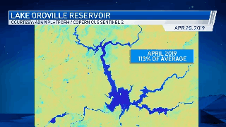
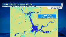
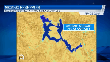
As drought intensifies across the Bay Area and the rest of California, the impacts to reservoirs can be easily seen from space.
These images via the Adam Platform Copernicus/Sentinel 2 satellite show how major reservoirs are being impacted.
Lake Oroville: April 2019 - April 2021
Get a weekly recap of the latest San Francisco Bay Area housing news. Sign up for NBC Bay Area’s Housing Deconstructed newsletter.
Nicasio Reservoir: April 2019 - April 2021
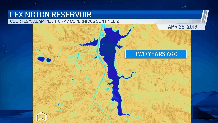
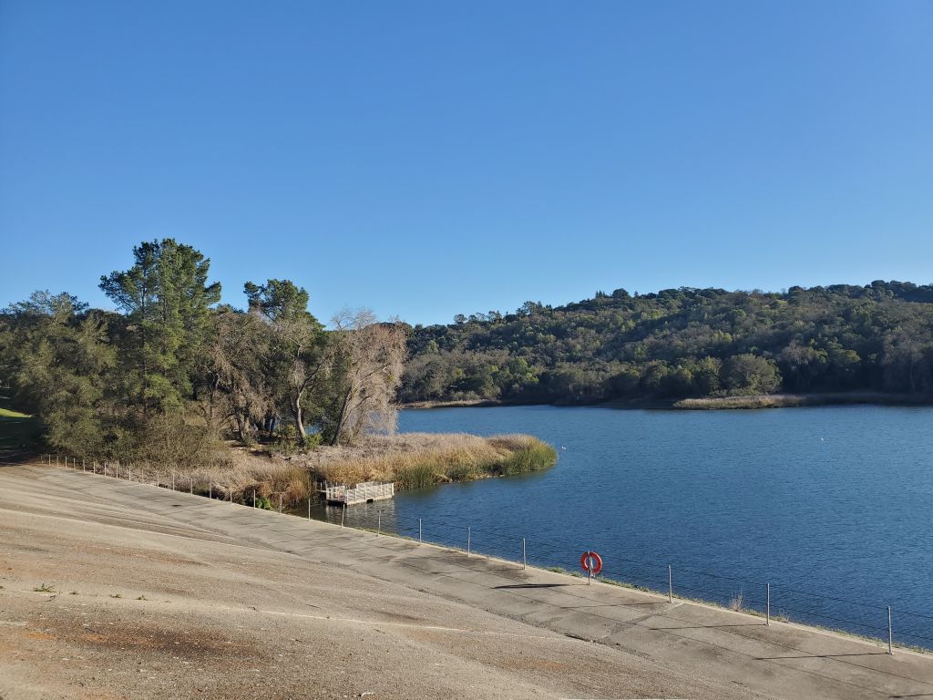
Lexington Reservoir: April 2019 - April 2021
Looking at levels of the state’s largest 12 reservoirs from April 2019 vs. today, the changes vs. historical averages are becoming more extreme, especially in Northern California, which is home to the largest reservoirs in the system.
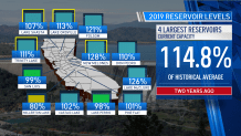
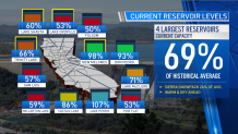
Declining water reserves and the Sierra snowpack – just 26% of average as of April 25 – are a telltale sign of our current drought expanding in coverage and intensity since last October
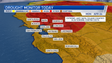
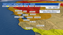
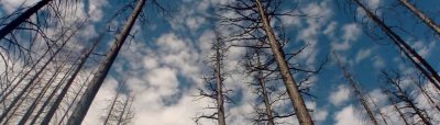
This increases the likelihood of an earlier and more intense start to fire season, according to Dr. Craig Clements of San Jose State’s Fire Weather Lab/Wildfire Research Center, due to fuel moistures being at near-summer dry levels in early April. Early and enhanced fire season danger extends well beyond California as drought intensity has increased considerably since October for much of the southwestern U.S. and eastward to the Rockies. In some cases, conditions are even more extreme/exceptional than we’re seeing here in California.
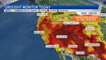
At a time of year when typically vegetation/wildfire fuel moistures ought to be near their highest for the year, instead many states are seeing summer dry conditions with summer still at least officially nearly two months away.
