
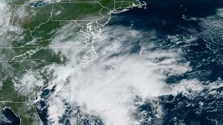
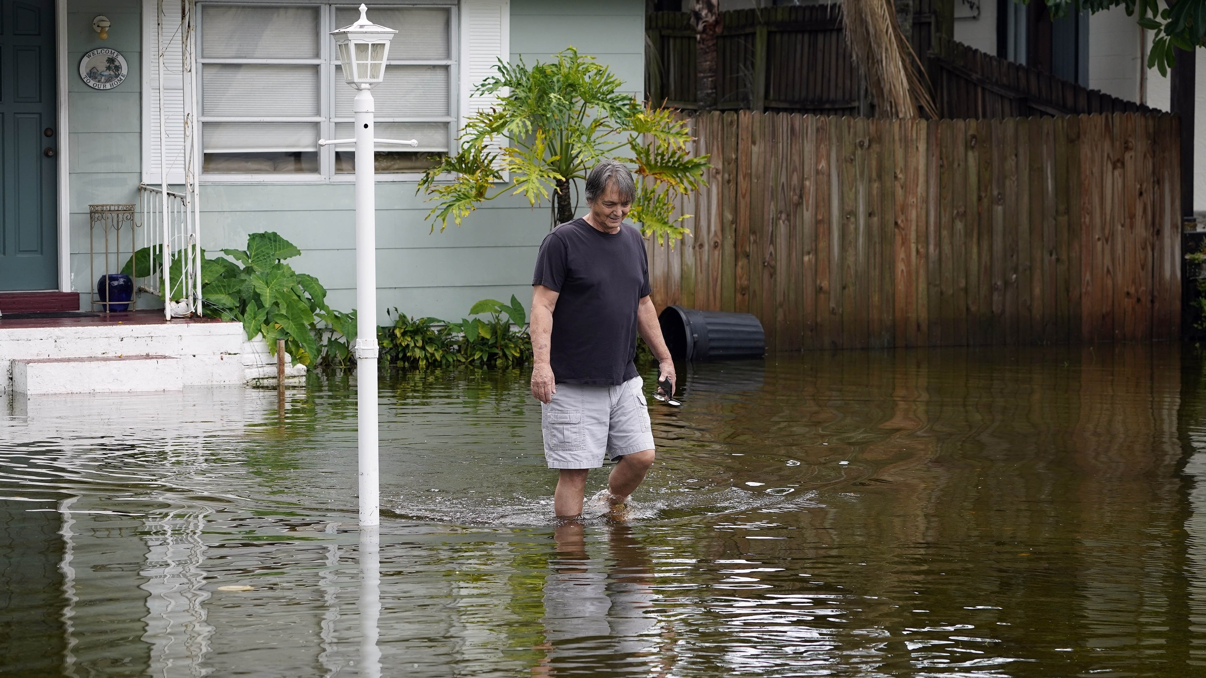
Residents in parts of coastal North Carolina and Virginia experienced flooding Saturday after Tropical Storm Ophelia made landfall near a North Carolina barrier island, bringing rain, damaging winds and dangerous surges.
The storm came ashore near Emerald Isle with near-hurricane-strength winds of 70 mph (113 kph) at around 6:15 a.m. but was expected to weaken as it moves north Saturday and then shifts northeast on Sunday, the U.S. National Hurricane Center said, noting that the maximum sustained winds had dropped to 45 mph (80 kph) by the afternoon.
Videos from social media showed riverfront communities in North Carolina such as New Bern, Belhaven and Washington experiencing significant flooding.
Even before it made landfall, the storm proved treacherous enough that five people had to be rescued by the Coast Guard on Friday night from a boat anchored down near the North Carolina coastline.
Get a weekly recap of the latest San Francisco Bay Area housing news. Sign up for NBC Bay Area’s Housing Deconstructed newsletter.
Ophelia promises a weekend of windy conditions and heavy rain as it churns up the East Coast, with the storm moving north at about 13 mph (21 kph) as of Saturday morning. Parts of North Carolina and Virginia can expect up to 8 inches of rain (20 centimeters), with 2 to 4 inches (5 to 10 centimeters) forecast in the rest of the mid-Atlantic region through Sunday. Some New Jersey shore communities, including Sea Isle City, had already experienced some flooding Saturday.
Philippe Papin, a hurricane specialist with the National Hurricane Center, said the primary risk of the storm system over the next couple of days will be the threat of floods from the rain.
“There have been tropical storm-force winds observed, but those are starting to gradually subside as the system moves further inland,” Papin said in an interview early Saturday. “However, there is a significant flooding rainfall threat for a large portion of eastern North Carolina into southern Virginia over the next 12 to 24 hours.”
Power outages spread through more states beyond North Carolina, where tens of thousands of homes and businesses remained without electricity across several eastern counties as of Saturday afternoon, according to poweroutage.us, which tracks utility reports.
“When you have that slow-moving storm with several inches of rain, coupled with a gust that gets to 30, 40 miles per hour, that’s enough to bring down a tree or to bring down limbs," Duke Energy spokesperson Jeff Brooks told WTVD-TV on Saturday. "And that’s what we’ve seen in most of the areas where we’ve experienced outages.”
Brian Haines, a spokesperson for the North Carolina Division of Emergency Management, said there were also reports of downed trees, but no major road closings.
“North Carolina Emergency Management continues to monitor the situation and to work with our county partners, who are currently not reporting any resource needs,” Haines said Saturday morning.
A storm surge warning, indicating danger from rising ocean water pushed inland by Ophelia, was in effect from Ocracoke Inlet, North Carolina, to Chincoteague, Virginia. Surges between 3 and 5 feet (0.9 and 1.5 meters) were forecast in some areas. A tropical storm warning was issued from Cape Fear, North Carolina, to Fenwick Island, Delaware.
Five people, including three children 10 or younger, needed the Coast Guard's help on the water when conditions worsened Friday. They were aboard a 38-foot (12-meter) catamaran anchored in Lookout Bight in Cape Lookout, North Carolina, stuck in choppy water with strong winds.
According to the Coast Guard, the sailboat's owner called them on a cellphone, prompting a nighttime rescue mission in which the crew used flares to navigate to the five people using a Coast Guard boat, then helped them aboard and left the sailboat behind. A Coast Guard helicopter lit up the path back to the station. There were no injuries reported and all five were wearing lifejackets.
The governors of North Carolina, Virginia and Maryland each declared a state of emergency on Friday and several weekend events were canceled. In Washington, the Nationals baseball team postponed its Saturday game until Sunday. The North Carolina Ferry System has suspended service on all routes until conditions improve.
Nancy Shoemaker and her husband Bob stopped to pick up sandbags on Friday in a park in Maryland’s capital, Annapolis. A surge of water during a storm last October washed away sandbags they put in their yard, which is right next to the water.
“We’re hoping it won’t be that way this time,” Nancy Shoemaker said. “If we have a lot of wind and a lot of surge, it can look like the ocean out there, so that’s a problem.”
It is not uncommon for one or two tropical storms, or even hurricanes, to develop right off the East Coast each year, National Hurricane Center Director Michael Brennan said.
“We’re right at the peak of hurricane season, we can basically have storms form anywhere across much of the Atlantic basin,” Brennan said in an interview Friday.
Scientists say climate change could result in hurricanes expanding their reach into mid-latitude regions more often, making storms like this month’s Hurricane Lee more common.
One study simulated tropical cyclone tracks from pre-industrial times, modern times and a future with higher emissions. It found that hurricanes would track closer to the coasts including around Boston, New York and Virginia and be more likely to form along the Southeast coast.
___
AP Radio reporter Jackie Quinn in Washington and AP writers Jonathan Mattise in Nashville, Tennessee, and Ron Todt in Philadelphia contributed.
