
Mother Nature is set to deliver a post-Christmas gift to the Bay Area: much-needed rain – but it could cause some problems.
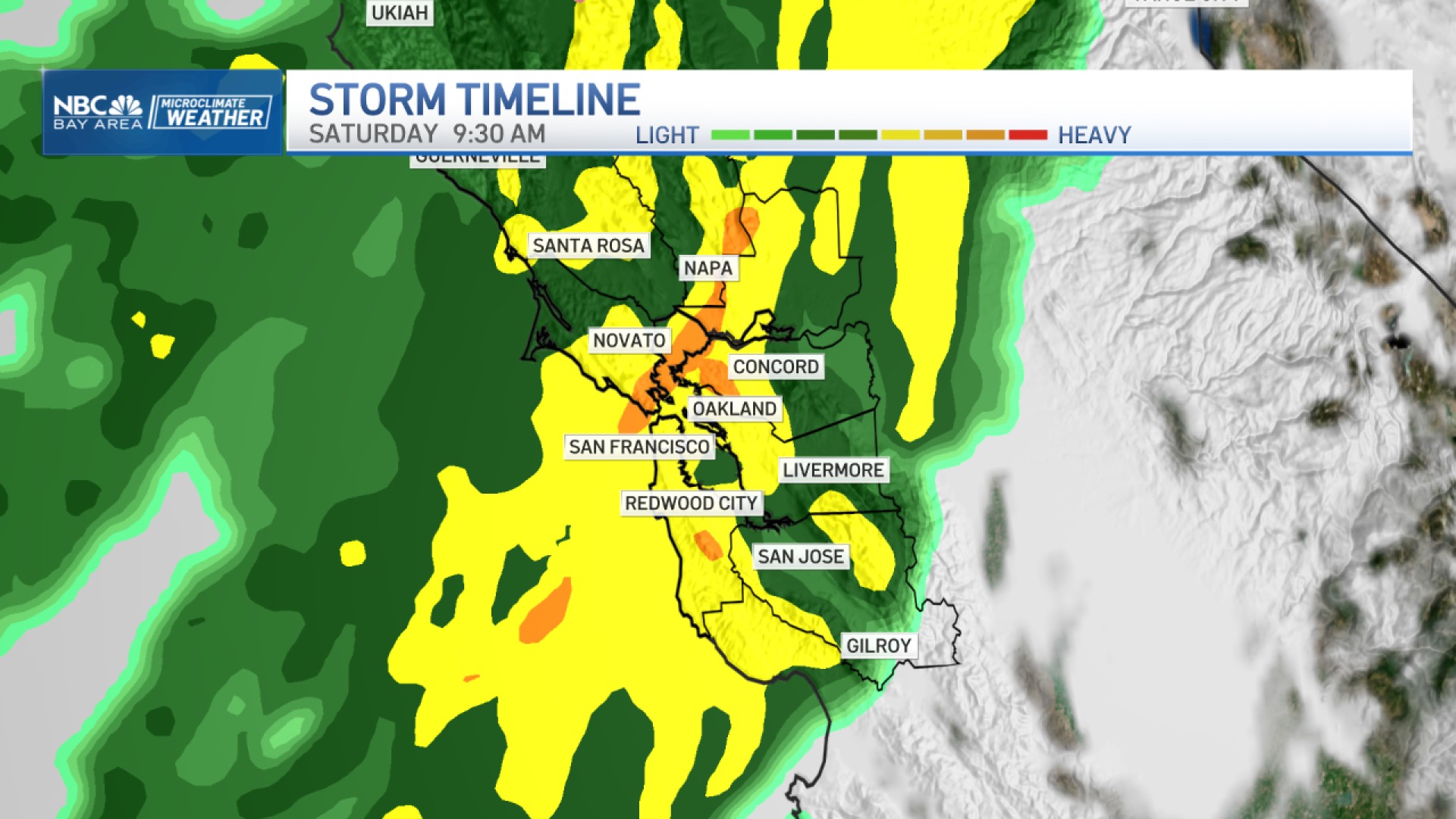
A "potent weather system" is forecasted to bring periods of moderate to heavy rain and gusty winds to the region beginning late Monday and continuing into Tuesday, according to the National Weather Service.
A flood watch has been issued for parts of the North Bay and the coast from 1 a.m. through 6 p.m. Tuesday.
Get a weekly recap of the latest San Francisco Bay Area housing news. Sign up for NBC Bay Area’s Housing Deconstructed newsletter.
Excessive runoff could cause flooding along rivers, creeks and streams as well as low-lying and flood-prone areas, the weather service said.
Rainfall totals in the coastal mountains could range from 2 to 4 inches and reach as high as 5 inches in some spots, according to the weather service. The interior mountain ranges are expected to pick up 2 to 3 inches of rain. The valleys are forecasted to receive 1.5 to 2 inches.
The storm system is also packing gusty winds. A wind advisory will be in effect from 10 p.m. Monday until 7 a.m. Tuesday for the Sonoma and San Mateo County coastlines, the North Bay mountains, the East Bay mountains, and the Santa Cruz Mountains, according to the weather service.
Areas along the coast could see wind speeds anywhere from 20 to 30 mph with gusts up to 50 mph. The higher elevations could have gusts peaking at about 60 mph.
Coastal areas will also contend with high surf. Waves up and down the Bay Area coastline could reach 12 to 17 feet in height, the weather service said.
Beachgoers are advised to keep a safe distance from the breakers, stay off rocks and jetties, and always keep an eye on the water.
In advance of the storm, the weather service is advising the public to clean out their gutters, remove leaves from storm drains, inspect their wiper blades, and tie down any loose objects and decorations.
For the latest forecast and weather updates, visit NBC Bay Area's weather page.
