
Gov. Gavin Newsom on Wednesday activated the state operations center of the California Office of Emergency Services, or Cal OES, triggering the coordination of federal, state and local agencies in response to the effects of a string of atmospheric rivers expected to move across the state over the next two to three weeks.
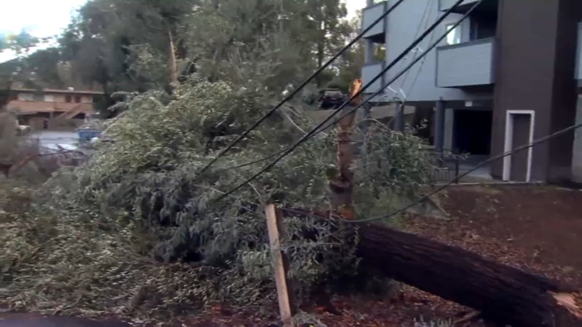
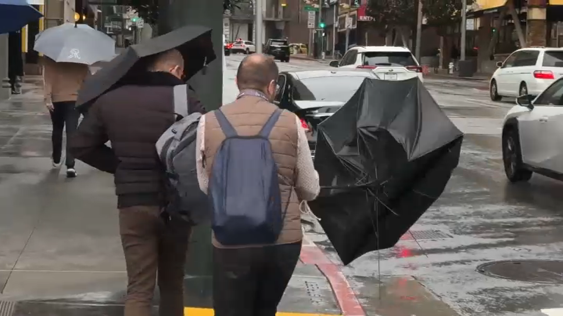
"The main impacts with this first storm system are going to be a lot of runoff from heavy rain," said meteorologist Robert Hart of the National Weather Service. "Damaging winds across the northern and central part of California may bring some pockets of tree damage and power outages."
A flood watch is in effect in the Bay Area from 4 a.m. Wednesday through 4 a.m. Friday. Potential impacts include rising waters in creeks, rivers and streams, including in cities, as well as ponding of water on roadways and other low-lying areas. There is also an increased risk of shallow landslides and rock debris on roads.
"Flooding and water kills more folks than wildfires and earthquakes every year," said Brian Ferguson of Cal OES, referencing the tragic loss of more than 20 lives statewide during the flooding last winter and spring.
Get a weekly recap of the latest San Francisco Bay Area housing news. Sign up for NBC Bay Area’s Housing Deconstructed newsletter.
"What we are looking at is not just what's going to happen today and tomorrow, but that this is a longer duration event," Ferguson said. "This is something that is going to take this week and into next week and maybe even the following week after that."
When a river water gauge reaches monitor stage, it triggers notifications to local flood emergency managers, said John Paasch, of the California Department of Water Resources, or DWR.
"When a location reaches flood stage, which is higher, it triggers heightened awareness and 24-hour levee patrols," Paasch said.
DWR has conducted 39 flood fight training courses to over a thousand individual members of state, local and tribal emergency response agencies in California, said Paasch. He said 5 million sandbags have been prepared and pre-positioned at 64 locations for quick deployment.
"We have approximately 1,200 pieces of equipment for snow operations up and down the state," said Sergio Aceves of Caltrans. "We will also be monitoring burn scar areas from recent wildfires for slide potential."
Paasch recommends that people avoid the roads, if possible, but advised people to inspect their vehicles before a trip, especially tire pressure and windshield wipers. He said to make sure to have a full fuel tank or a fully charged electric vehicle.
"We recommend to always carry chains and blankets. Keep your cellphone fully charged. And please never go around any of our road closures or barricades. They are there for your safety. Please do not do that," Paasch said. "It will imperil not just you as a driver, but our crews that are out there doing their work. If you see emergency crews or first responders, slow down."
Cal Fire's swift water rescue teams are on alert statewide, said Cal Fire's Nick Schuler.
"Today, not tomorrow, is the time to talk with your family, support your elderly neighbors, and ensure that you are prepared," said Schuler. "Have an evacuation plan, a go bag with essential medications and necessary documents. Plan for your pets."
Individuals who are most at risk are people experiencing homelessness, or perhaps members of an immigrant and refugee community, said Ferguson of Cal OES.
"They are disproportionately impacted by all disasters, whether that's a wildfire, a flood or earthquake," he said.
"There are many local law enforcement agencies actually out today doing broadcast, using their speakers, driving through our river or stream systems that we know are going to be flooded," said Ferguson, referring to the number of people who camp near waterways.
"We have more water in our reservoirs this year than we've had last year. So, there will be more spillways, more gates open, which will result in more water coming into our stream systems," he said.
The California Department of Social Services works very closely with the American Red cross and local county health and human services agencies to facilitate shelters during any sort of disaster. They expect shelters will open over the next several days.
Federal agencies are preparing as well. The California National Guard, which just used its highwater vehicles to rescue flood victims in the San Diego area, are ready to conduct search and rescue operations in case of disaster.
"We also have aviation search and rescue assets, as well as general aviation that can respond," said Robert Paoletti, brigadier general and director of the joint staff of the California Military Department. "We have military police that can assist local jurisdictions with traffic control around the flooded area. And we also have a lot of general engineering, heavy engineering equipment that can come and help with debris flows."
People should sign up for alerts from their county, which is the first line of defense to get notifications about dangerous actions happening in their community.
"These alerts come from local officials on the ground, typically the sheriff or the county office of emergency services," Ferguson said, warning against the dangers of misinformation during natural disasters.
"We are seeing more myths and disinformation online with this round of storms that we've seen for almost any disaster in the past," he said. "Part of that is just our changing media environment of people watching things on TikTok and Instagram. We have bad actors, both at the state and outside the country, who are trying to use disasters to turn Americans and Californians against each other."
Sign up for alerts from local county emergency management offices. All 58 county offices can be found at listoscalifornia.org.
California Office of Emergency Services preparedness resources can be found at listoscalifornia.org.
Caltrans' QuickMap provides the most up-to-date weather and road conditions at quickmap.dot.ca.gov.
Emergency shelter can be found through county emergency services and there is a map of locations at gis-calema.opendata.arcgis.com.
For real-time river conditions and announcement, visit the California Department of Water Resources Data Exchange Center at cdec.water.ca.gov. Real-time gauge levels can also be found online with the U.S. Geological Survey.
